
What is the San Andreas Fault?
By David K. Lynch, PhD, author of SanAndreasFault.org.
The San Andreas Fault is the sliding boundary between the Pacific Plate and the North American Plate. It slices California in two from Cape Mendocino to the Mexican border. San Diego, Los Angeles and Big Sur are on the Pacific Plate. San Francisco, Sacramento and the Sierra Nevada are on the North American Plate. And despite San Francisco’s legendary 1906 earthquake, the San Andreas Fault does not go through the city. But communities like Desert Hot Springs, San Bernardino, Wrightwood, Palmdale, Gorman, Frazier Park, Daly City, Point Reyes Station and Bodega Bay lie squarely on the fault and are sitting ducks.
What Type of Fault is the San Andreas?
The San Andreas Fault is a transform fault. Imagine placing two slices of pizza on the table and sliding them past one another where they touch along a common straight edge. Bits of pepperoni from one side crumble across the boundary onto the anchovy side. The same thing happens with the fault, and the geology and landforms along the mighty rift are extremely complicated.
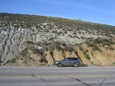
You Can See a Plate Boundary! Photo of the San Andreas Fault near Gorman, California, showing rocks of the Pacific Plate (gray rocks on the left side of the fault) and the North American Plate (tan rocks on the right side of the fault). There are very few places on Earth where you can see two plates in contact like this. Photograph copyright by David Lynch. Click to enlarge.
How Fast Does It Move?
The plates are slowly moving past one another at a couple of inches a year - about the same rate that your fingernails grow. But this is not a steady motion, it is the average motion. For years the plates will be locked with no movement at all as they push against one another. Suddenly the built-up strain breaks the rock along the fault, and the plates slip a few feet all at once. The breaking rock sends out waves in all directions, and it is the waves that we feel as earthquakes.
(...)
The San Andreas Fault is the sliding boundary between the Pacific Plate and the North American Plate. It slices California in two from Cape Mendocino to the Mexican border. San Diego, Los Angeles and Big Sur are on the Pacific Plate. San Francisco, Sacramento and the Sierra Nevada are on the North American Plate. And despite San Francisco’s legendary 1906 earthquake, the San Andreas Fault does not go through the city. But communities like Desert Hot Springs, San Bernardino, Wrightwood, Palmdale, Gorman, Frazier Park, Daly City, Point Reyes Station and Bodega Bay lie squarely on the fault and are sitting ducks.
About the Author
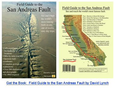
David K. Lynch, PhD, is an astronomer and planetary scientist living in Topanga, CA. When not hanging around the fault or using the large telescopes on Mauna Kea, he plays fiddle, collects rattlesnakes, gives public lectures on rainbows and writes books (Color and Light in Nature, Cambridge University Press) and essays. Dr. Lynch's latest book is the Field Guide to the San Andreas Fault. The book contains twelve one-day driving trips along different parts of the fault, and includes mile-by-mile road logs and GPS coordinates for hundreds of fault features. As it happens, Dave's house was destroyed in 1994 by the magnitude 6.7 Northridge earthquake.
San Andreas Fault Line - Fault Zone Map and Photos
http://geology.com/articles/san-andreas-fault.shtml


Komentarze
Pokaż komentarze